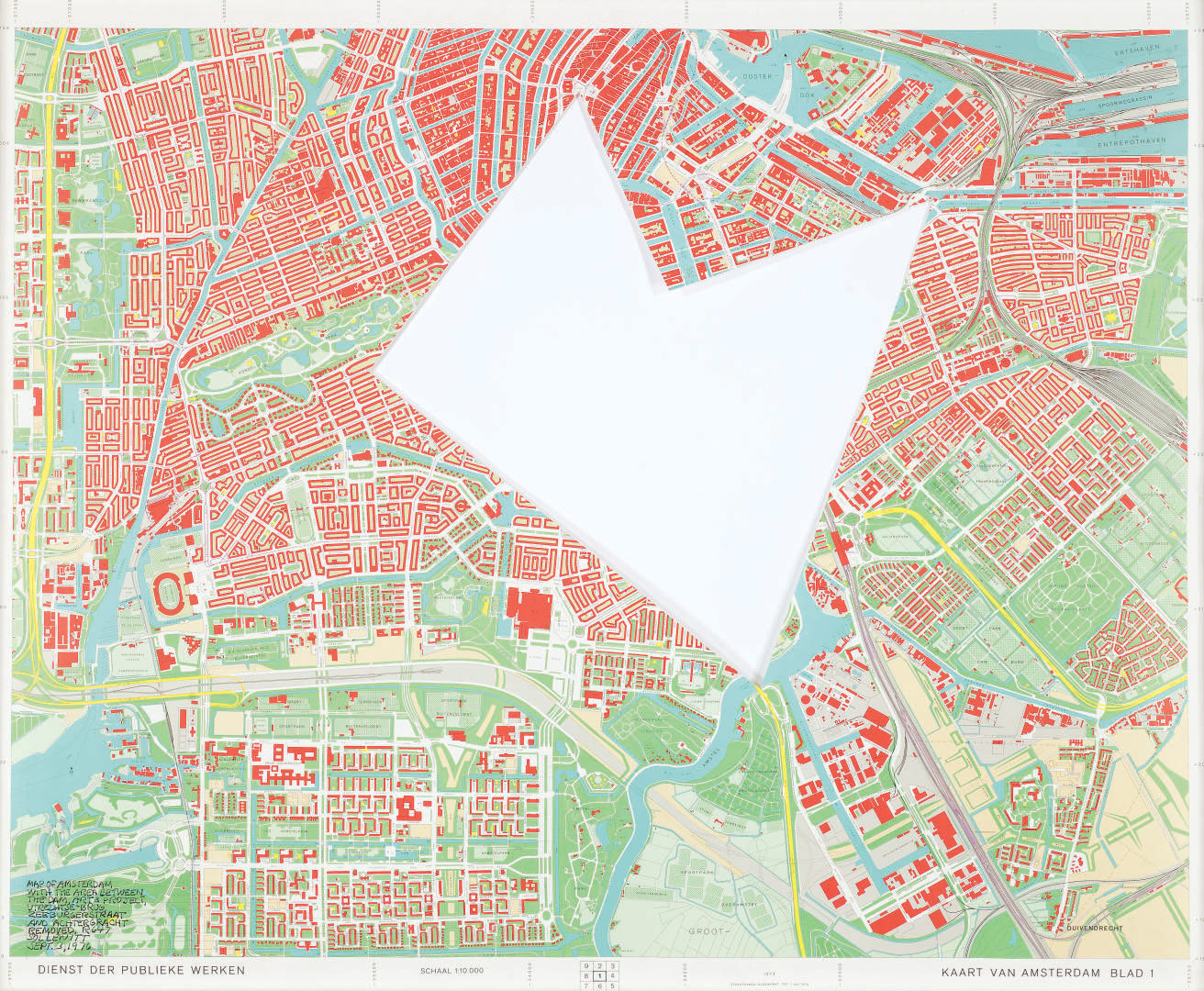
Map of Amsterdam with the area between the Dam, Art and Project, Utrechtse-Brug, Zeeburgerstraat and Achtergracht, removed, R. 647
$500
SOL LEWITT (1928-2007)
Map of Amsterdam with the area between the Dam, Art and Project, Utrechtse-Brug, Zeeburgerstraat and Achtergracht, removed, R. 647
signé, titré et daté 'MAP OF AMSTERDAM WITH THE AREA BETWEEN THE DAM, ART & PROJECT, UTRECHTSE-BRUG, ZEEBURGERSTRAAT AND ACHTERGRACHT REMOVED,
R. 647 SOL LEWITT, SEPT. 3, 1976' (en bas à gauche)
plan de ville découpé
64.5 x 80.3 cm. (25 3/8 x 31 5/8 in.)
Réalisé en 1976.